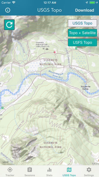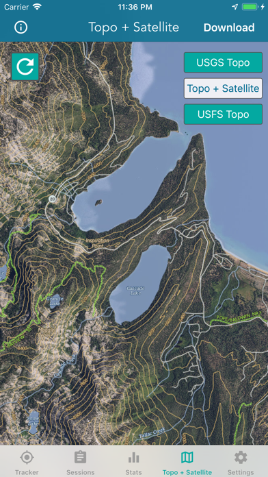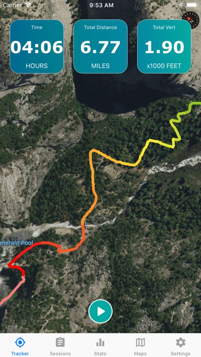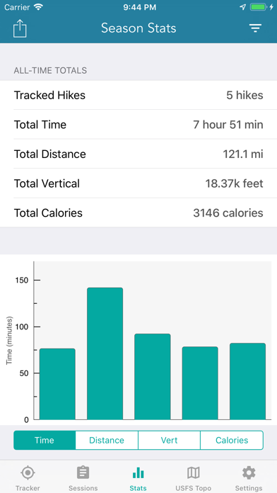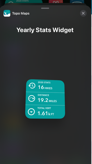


DOWNLOAD ALL MAPS FOR OFFLINE USE MAIN FEATURES INCLUDE: - USGS Topographic Maps - Satellite + Topo Maps - Hiking Tracker USGS TOPO MAP USGS Topo is a tile cache base map service that combines the most current data in The National Map (TNM), and other public-domain data, into a multi-scale topographic reference map. TOPO + SATELLITE USGS Imagery Topo is a tile cache base map of orthoimagery in The National Map and US Topo vector data. Orthoimagery data are typically high resolution images that combine the visual attributes of an aerial photograph with the spatial accuracy and reliability of a planimetric map. Data themes included are Boundaries, Geographic Names, Transportation, Contours, Hydrography, Land Cover, Shaded Relief, Trails, etc. HIKING TRACKER Now you can track all of your hiking stats! - Track total distance, vertical, time - Track calories burned - Keep track of yearly stats - Color coded tracks by elevation - Backup your hike data to iCloud - iOS 14 home screen widget Have questions? Feel free to contact me at support@lwbrandsllc.com